No complete winter season forecast: meteorologist
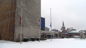
The first snow of the season pictured in front of City Hall. Photo by Bernard DeVaal.
One would like to think that with current technology we’d at least be able to forecast what the weather will look like a month in advance. That however, is not the case.
Peter Kimbell, meteorologist with Environment Canada warns that it is very difficult to make an accurate weather prediction looking further into the future.
Hearing forecasts that mention it going to be “a classic Canadian winter,” or that “temperatures will be the lowest in five years” is misleading.
“It’s just too difficult to forecast with certainty. There’s a lot of variability that occurs and the forecast models change quite frequently.”
He goes on to say that being told that it will be a colder or a warmer winter than previous years just isn’t a possibility.
“Things do change quickly. So there just really isn’t the ability to say confidently whether it’s going to be warmer or colder. I know people do it all the time, but this skill really isn’t all the greatest,” said Kimbell.
“I prefer to stick to the next week, sometimes two weeks.”
It is probably the safest to view statistics from previous winters in making a prediction. Kimbell says that -29 degrees was the coldest temperature measured in 1994.
He goes on to say, “Typically Windsor sees about 130 cm of snowfall during the winter.”
In January the temperature would range between 0 and -10. The average high in January is 0.3 and the average low is -7.3.
Another theory that is debunked by Kimbell is what is referred to as “the lake effect.” Higher temperatures of the lakes supposedly lead to higher levels of precipitation that increases chances of rain and snow over cities surrounding these areas. This theory often cited as reason for a colder and wetter winter season.
Although rising precipitation levels aren’t untrue, Kimbell says it’s impossible to make a prediction of what the winter season will be like based on this theory.
“Lake temperatures respond really quickly to surface temperatures,” said Kimbell. He offers an example:
“Say, at the end of October, the lake temperatures are warmer than usual, some might want to say that there will be more snow than usual, but that is misleading,” said Kimbell. “In November the lake temperatures will rapidly cool down to normal, or even below normal.”
The lakes freeze over so it’s not possible to assume that warmer temperatures in October would still have any sort of effect.
With those simple, common sense perimeters, here is your two-day forecast for Windsor.
An expected 8-15 cm of snow is predicted for today and tomorrow for Windsor.
It is also safe to assume that the rest of the week will remain cold.

